


CiviLab 2025: Civil engineering laboratory software
CiviLab is a software dedicated to civil engineering laboratories for the analysis of soil and concrete tests according to ASTM, NF, NA, and BS standards.
More information


RDS 2021: Road Design Software
RDS is a low cost infrastructure software dedicated to companies to carry out all categories of linear projects such as road projects, pipeline network projects and sewage network projects. Our software has a simple, intuitive interface and gives the user great flexibility to design linear projects.
More informationNews
- CiviLab:
- Add NF P 94-116 and NA 52 29 standards to SPT test.
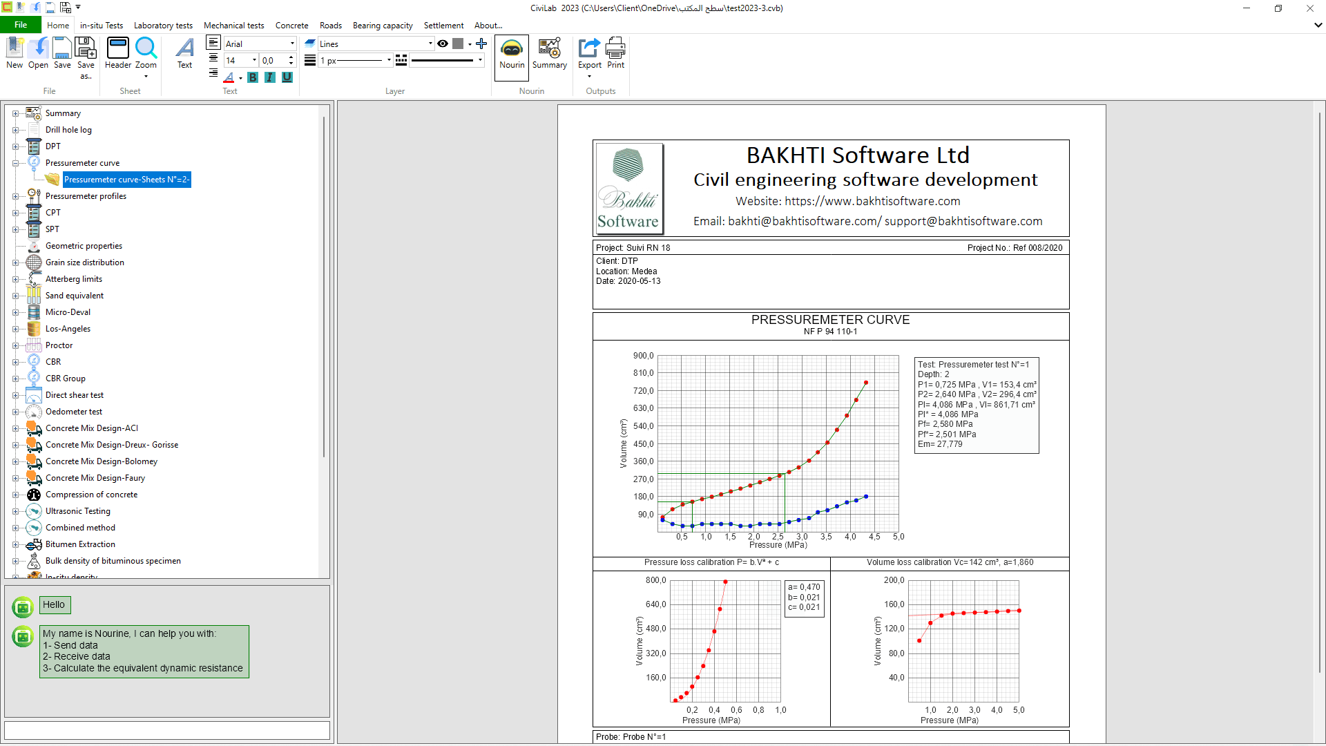
- Automatic calculation of E(i) from a pressuremeter profile for settlement estimation.
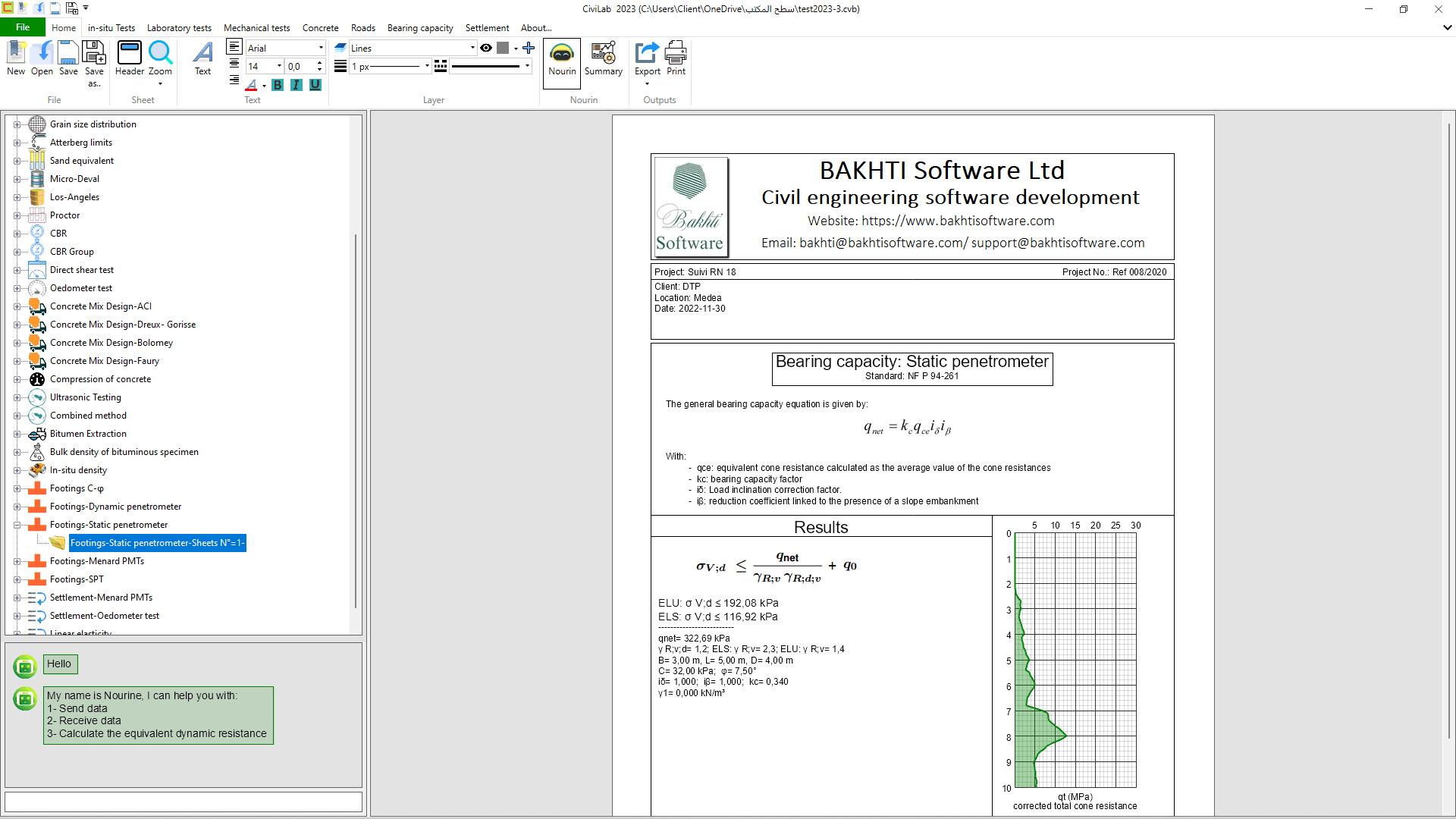
- Automatic calculation of qle* from a pressuremeter profile for bearing capacity.
- Automatic calculation of qce from a CPT profile for bearing capacity.
- Automatic calculation of De from a pressuremeter profile for bearing capacity.
- Automatic calculation of De from a CPT profile for bearing capacity.
- Automatic calculation of qde from a DPT profile for bearing capacity.
- New presentation sheet for settlement calculation from pressuremeter tests, with more details.
- New presentation sheet for settlement calculation based on elasticity theory, with more details.
- New presentation sheet for bearing capacity from pressuremeter tests, with more details.
- New presentation sheet for bearing capacity from CPT tests, with more details.
- New presentation sheet for bearing capacity from DPT tests, with more details.
- Correction and improvement of the imperial unit system.